Mardin Castle: The “Eagle’s Nest” Over Mesopotamia
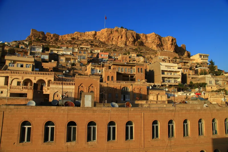
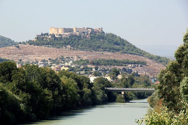
Perched on a kilometer-high cliff, its precipice overlooking the Mesopotamian plain, stands Mardin Kalesi—the “Eagle’s Nest,” as the locals call it. From here, one can see as far as the Iraqi border, and it was from this very spot that the honey-colored stone city was ruled for centuries. The Artukids made Mardin their capital, the Ottomans maintained a garrison, and today a NATO radar station stands at the summit; the fortress remains a military zone—but even the climb to its walls is worth it for the view and the panorama.
History of the Fortress
Mardin Kalesi is one of the oldest continuously used fortifications in Southeastern Anatolia. Its age is estimated at approximately 3,000 years: the first fortifications on this rock are attributed to the Assyrian-Aramaic era. According to local legend, the fortress was built by the Babylonian Zoroastrian Shad Bukhari in the 4th century BCE, who was healed of an illness on this summit.
Documented stages of construction begin with the Hamdanid dynasty in the 10th century. The fortress reached its peak during the Artukid era (11th–13th centuries): they made Mardin the capital of their beylik and transformed Kalesi into a fully-fledged “upper city” with palaces, mosques, and cisterns. After the Artuqids, the fortress passed to the Ayyubids, the Mongols, the Ak Koyunlu, and finally to the Safavids and the Ottomans. Selim III carried out a partial restoration in the late 18th century.
In the 20th century, the fortress became a military facility. During the events of 1915, according to several sources, the citadel’s premises were used as a prison for arrested Armenians. Since the mid-20th century, Mardin Kalesi has been a restricted military zone, currently housing NATO radar stations. Since 2008, plans to open the site to visitors have been periodically discussed, but they have so far been blocked by its military status.
Architecture and What to See
The Rock and Walls
The citadel is situated on a long, table-shaped rock (about 1,200 meters above sea level, with a drop of up to 1,000 meters to the plain). The walls run along the edge of the cliff and are reinforced with rectangular towers at the most vulnerable points. The masonry is multi-phase: Artukid blocks of yellowish Mardin limestone coexist with later repairs.
Artukid Structures
Within the fortress grounds, the ruins of Artukid palaces, mosques, and cisterns remain. The most famous mosque is the small Kale Camii from the Artukid era, which has partially survived to the present day.
Approaches and Gates
The main ascent to the fortress winds its way up from the upper part of the old city. Several levels of gates have been partially preserved; the modern army uses one of them for official purposes. Tourists are generally only allowed up to a certain point on the slope.
Panorama
From the slopes beneath the walls, one of the most spectacular panoramas in Turkey unfolds: the waves of Mardin’s honey-colored stone houses, the turquoise domes of the madrasas, and beyond—the endless Mesopotamian plain and the silvery thread of the Tigris River.
Interesting Facts
- The fortress’s local nickname is “Kartal Yuvası,” or “Eagle’s Nest”: on a clear day, you can see up to 100 km deep into Mesopotamia from it.
- During the Artukid era, the fortress housed a fully-fledged “upper city” with a palace, mosques, and bathhouses—effectively a residence of the dynasty parallel to Mardin.
- An active military base and a NATO radar station are located within the fortress grounds—therefore, full access to tourists is restricted.
- The citadel stands on a cliff about 1,200 m above sea level and nearly a kilometer above the plain—this is one of the region’s largest absolute elevation differences in fortifications.
- The Old City of Mardin is on UNESCO’s tentative list, and the citadel is considered a key element of the city’s skyline.
How to get there
The fortress is located in the Artuklu district of Mardin, at coordinates 37°18′56″ N, 40°44′33″ E. You can hike to its base from the upper street of the old town (1. Cadde)—the steep climb takes 30–45 minutes. By car, the road leads to one of the viewing platforms just below the military zone.
The nearest airport is Mardin (MQM), about 20 km away. The distance from Diyarbakır to Mardin is about 100 km by highway. The old town is easy to explore on foot: everything is compact, and any walk will eventually lead you to the slope below the fortress.
Tips for travelers
Keep in mind that tourists are generally not allowed inside the fortress: it is an active military zone. But even the approaches to the walls and the terraces below the cliff offer incredible views and atmosphere. Do not attempt to photograph military installations, antennas, or soldiers—it is prohibited and can lead to problems.
The best time to visit is spring (March–May) and fall (October–November). In summer, the stone city heats up to 40°C; in winter, there are cold winds and occasional snow. Watching the sunset from the terraces below the fortress is a must: the honey-colored stone glows orange-gold, and the Mesopotamian plain fades into the haze.
Combine your visit with a stroll through old Mardin: the Zinciriye Madrasa, Ulu Camii, the Church of the Forty Martyrs, and the bazaar. You should set aside at least a full day to explore the entire historic center, including the climb up to the fortress walls.
Wear non-slip shoes with treads: the stones of the old city and the paths to the fortress have been polished smooth over the centuries. Bring water with you: there are no kiosks on the upper slopes.